
Because I avoid corporate services like Google Maps, it’s necessary to have a companion app for public transit on my phone. While OpenStreetMap apps like OSMAnd and OrganicMaps have some limited transit features (in select areas,) they don’t have live bus times or other quality of life features.
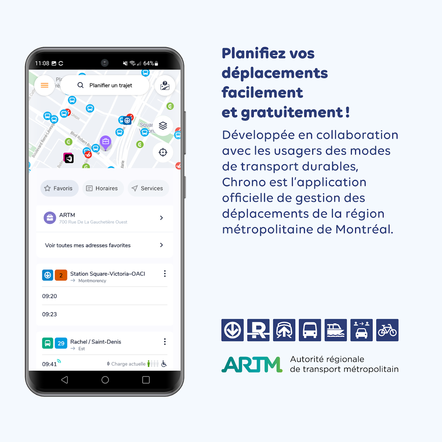
A quick visit to the STM’s website gives us a list of possible apps to try. Two are recommended explicitly by the STM: Transit App, and Chrono.
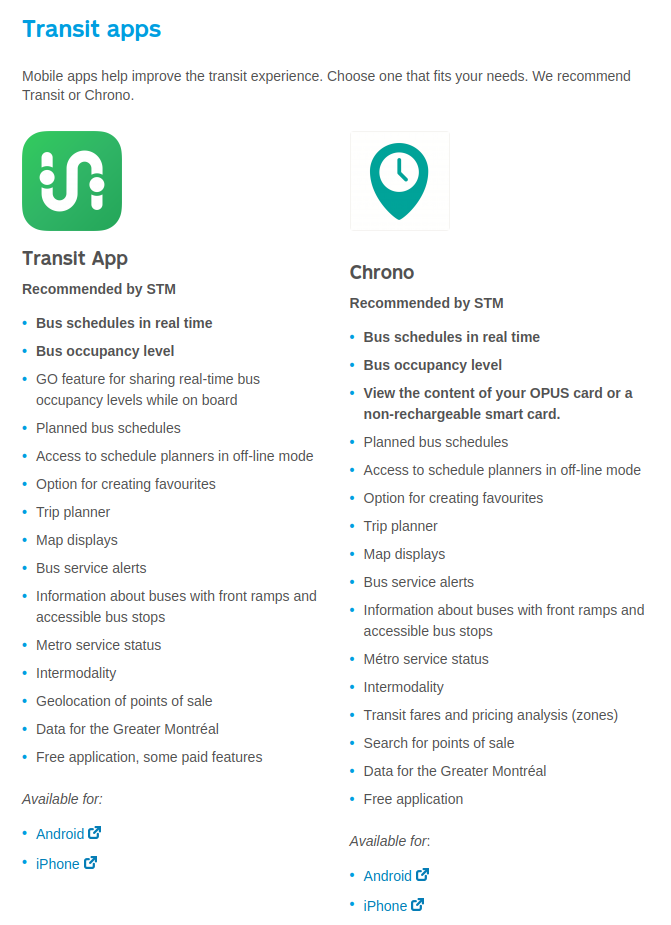
A quick look at the features list shows that they have very similar features. However, Chrono is “free,” while TransitApp is “free, with some paid features.” I’m not opposed to paying for a good app, but given that I don’t use Google Play, this made TransitApp unappealing. Furthermore, Chrono is listed in the Play Store as being made by the ARTM, Montréal’s transit authority. So to me, the choice was clear. I downloaded the Chrono app.
First Impressions
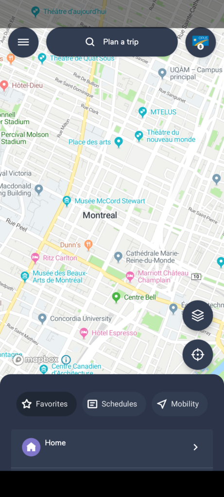
I was immediately impressed by Chrono. While it used Google Maps as a base map source when I first downloaded it, it quietly switched to OpenStreetMap data via MapBox a few weeks later. Panning and zooming the map is fast and responsive. It shows me locations where I can recharge my Opus card, as well as Bixi stations complete with bike counts. It requires an internet connection, but this is normal for any app with live data.

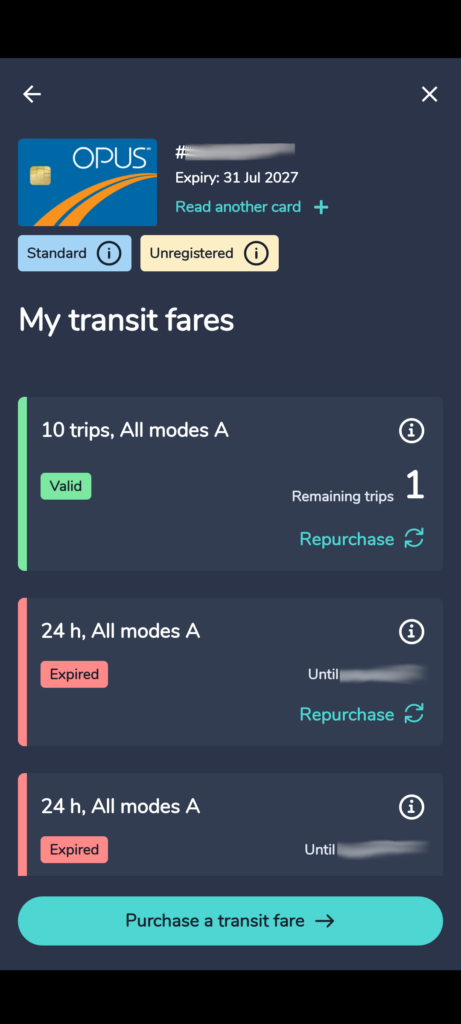
I noticed that Chrono allows you to read from your Opus card with your phone’s NFC reader — something that I found to be quite fancy, given that this is my first phone in close to a decade with a functioning NFC module. When I first started using Chrono is only allowed you to read from cards, but more on that later. Being able to see how many passes I had left helped me decide whether to wait for a bus or to walk to the Métro, so I was excited by this feature.
Navigation was very intuitive, though the default sorting for transit options was a bit confusing. It neither showed the fastest option first, nor the option that would get you to a destination earliest. This feature says “powered by Google” at the bottom, which is a bit of a letdown. Still, the options were displayed in very intuitive ways, making use of the STM’s colour-coding of its Métro lines and also highlighting rapid buses in pink.
Navigation for biking was not as good. This is also “powered by Google” — which immediately strikes me as problematic given that Google’s information on bike infrastructure in the area is at best outdated and at times completely fabricated. I immediately went back to OrganicMaps for bike navigation.
Navigating the system
With phone in hand, I set out to make the long trek to a region I haven’t visited on transit. Most of the trip I have taken a thousand times before: a bus to the nearest Métro station, then taking the Green Line downtown. Chrono gave me a few options for buses to take for the final leg of the trip, and I decided to hold off on choosing one until I was on the Métro and could better gauge which would be the easiest to connect to without waiting out in the cold for a long time.
The first oddity I noticed about Chrono’s navigation was the so-called “realtime” bus schedules. Upon arriving at my bus stop, I immediately noticed a large discrepancy between Chrono’s estimation of when the bus would arrive and when the live display at the stop said it would. Chrono ended up being the incorrect one here, as the bus it said would arrive in 2 minutes never manifested. Instead, the bus came right on the time that the stop’s display said it would, around 10 minutes later.
This was frustrating, because had the times in the app been correct, I could have taken a different bus and spent less time standing in the cold.
Finally on the Métro, I looked at my bus options for the final leg of the journey and selected one, making a mental note that the times were likely incorrect. One frustration I had about the app at this point was that it doesn’t tell you the stop number where you will catch a bus, so there isn’t a way to easily look up the schedule online or by texting the STM’s SMS service. I opted to take the bus with the most direct route to my destination: the 107-S.
Upon exiting Station Peel, I tried to use Chrono to wayfind the correct corner for my bus stop. Due to the way it displays buildings and POIs I found this difficult, and ultimately had to use OrganicMaps for this task. However, when I arrived at the location indicated on Chrono’s map, I found no trace of a bus stop. Not even a sign from the STM indicating the stop had been moved.
I went to the opposite corner to look at the sign for the northbound version of the bus, which had a temporary sign from the STM indicating that the stop had moved. There was no map attached, but it did give a cross-street. So I walked one block north and found the replacement stop for the northbound service, but still none for the southbound service.
At this point I was very frustrated. Why does an official app from the ARTM not have the correct route information? Why does the STM do such a bad job of signing their redirected stops? I selected another bus option and walked 700m to a stop for another bus.
Integrations
One thing that Chrono does very well is its integrations. Not only can you read data from your Opus card, but as of the last update I am even able to reload my card from it (and I am not in a beta testing group!) This is extremely useful given that before I had to walk all the way to a Métro station to do so, since the local vendors shown on Chrono’s map only accept cash for purchasing STM fares. Sadly, Chrono could not read my credit card via NFC, and I had to input the information manually.
You can also log in to your Bixi or Communauto accounts from Chrono, and use it to find the nearest stations and even to unlock Bixi bikes. I haven’t been able to use this yet, but look forward to not needing a separate app for it.
It seems that the ARTM has a holistic view of mobility in the Montréal area. I’m glad that they integrated bike sharing into their transit app, and that the app also provides biking navigation. I do wish that they provided better bike navigation, from a data source like OpenStreetMap or even from the city’s own bike network database, but it is still nice to have it in one place. Since most people are used to Google Maps’ directions already, they are unlikely to notice the poor quality of the directions.
Room for improvement
Chrono has a long way to come in terms of being a great navigation app. Its inability to provide walking directions is a major flaw, and its bicycle navigation could be improved significantly by moving away from Google as a dependency.
When it comes to accessibility, this app could do some simple things to make navigating easier.
- Improve street name visibility on the map tiles. I found it very hard to see street names without zooming in extremely far.
- List bus stop numbers on navigation directions. This would make it easier to know if you’re at the correct stop.
- Add a compass rose that can be tapped to reorient the map, or at least indicate which way is north. This is why I ultimately had to switch to OrganicMaps to determine which corner I was on.
- Fix real-time bus times. Although this is supposedly already a feature, I found it to be incredibly inaccurate compared to the real-time displays at bus stops.
- Make rerouted buses display their real, on-the-ground routes. The ARTM must be aware of what these routes are, since they are the transit authority, after all. I found it impossible to find my stop without this feature. In general, I think that communication regarding rerouted stops is bad for the region, often lacking physical signage, maps, arrows, or even employees to ask at major Métro stations with bus loops. This is something I will write about more in the future.
- For a longer-term goal, consider adding a live feed for how many more stops before your destination for buses. When taking a new route, I had to predict where the stops might be and worried about when I should request a stop without it being too early or too late.
- Improve physical accessibility by allowing users to request routes that only use Métro stations with elevators, and bus stops that are wheelchair accessible.
- Improve bicycle routing by using better data than Google’s, and by showing some kind of name on the suggested routes to help users choose which one they would like to use. Currently they say nothing, so you have no idea which one is which. Displaying the options on the map would also be helpful.
Final thoughts
All in all, I would still recommend Chrono to someone living in Montréal. Its Opus card features alone are enough to make it better than Google Maps, and despite its shortcomings it has the potential to be an amazing all-in-one solution for mobility in the region. Investment from the ARTM into its development has the potential to make the dedicated Bixi app unnecessary, as well the need for a dedicated apps map for many people. It has already added many new features since I first downloaded it, and I look forward to seeing the developments from Chrono in the near future!
Leave a Reply